 |

 Sources - Papers |
||||||||||||||
|
|
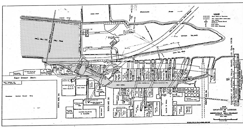
CENTRAL MINNEAPOLIS RIVERFRONT PART 1: HISTORICAL OVERVIEW AND ARCHAEOLOGICAL POTENTIALS
|
||||||||||||||
|
|
Sources - Papers |
||||||||||||||
|
|
CENTRAL MINNEAPOLIS RIVERFRONT PART 1: HISTORICAL OVERVIEW AND ARCHAEOLOGICAL POTENTIALS
|
||||||||||||||
|
|
|
© 1999 The Institute for Minnesota Archaeology Email us: feedback@fromsitetostory.org Updated 27 Aug 2000
|